Survey methods
Data collection
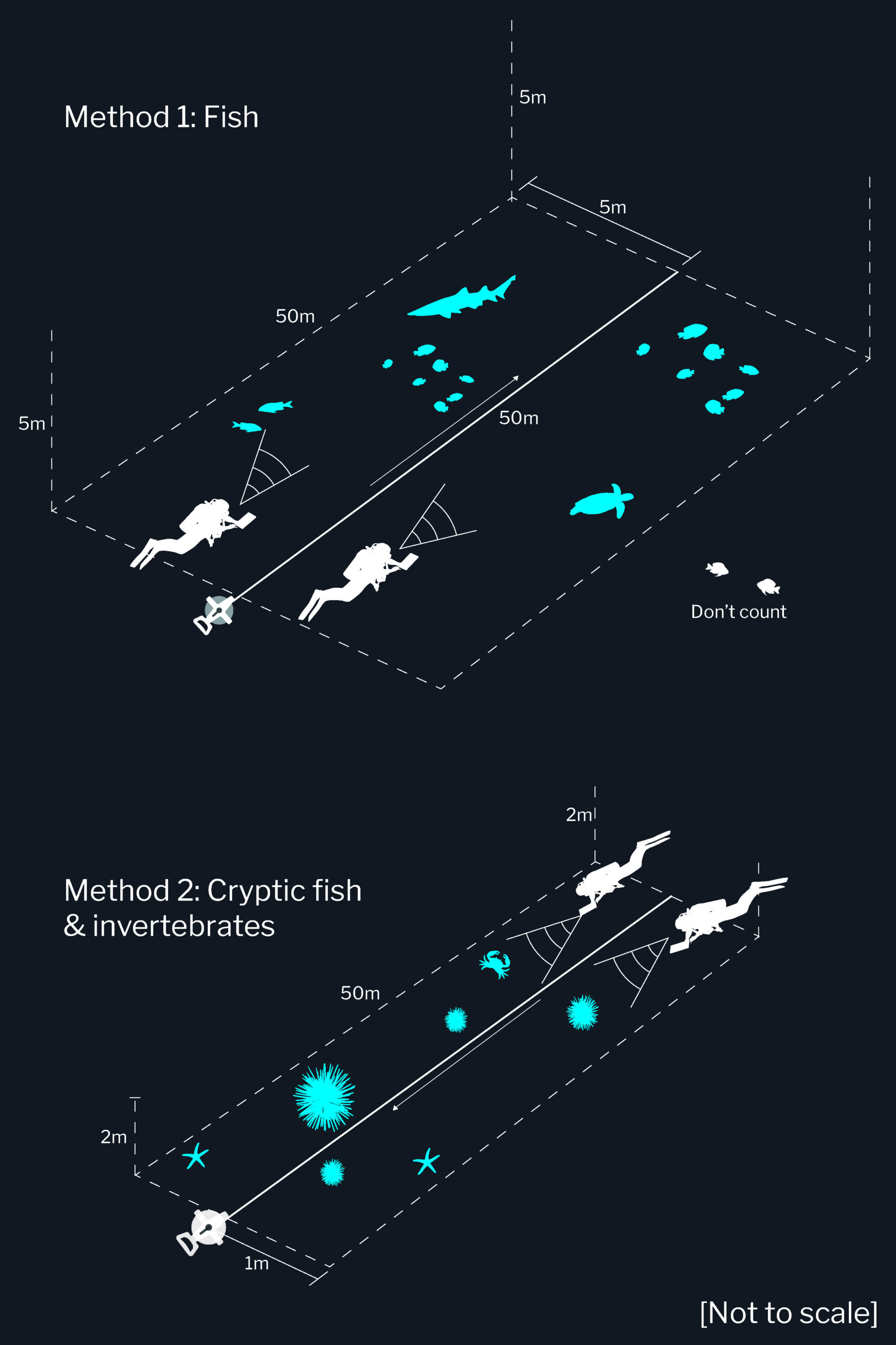
Our survey methods involve divers recording fish and invertebrate species seen along 50m underwater transects using waterproof pencils and paper.
Although not high-tech, when undertaken by experienced surveyors these methods allow coerage of species not able to be recorded by other methods, and are both cost- and time-effective. Photographs are also taken of the coral or seaweed cover on each survey.
The complete methods cover the majority of plants and animals greater than 2.5cm in length that make up the life of rocky and coral reefs.
download the rls methods manual
data entry
Data entry is completed via specially-designed MS Excel templates which contain species and site lists for specific regions.
To download the latest data entry templates, click on a pin on the map below.
Instructions on completing data entry using these templates can be found in the RLS methods manual, and RLS volunteers can access the data validation app through the link below.
Note: Not all regions surveyed by RLS have data templates currently available.
Contact us at [email protected] for bespoke datasheets or queries relating to data.